Project Info

| Client | Subic-Clark Alliance for Development Council |
| Location | Region 3 – Central Luzon, Philippines |
| Country | Philippines |
| Period Covered | October 2008 - July 2009 |
| Associated Consultant | None |
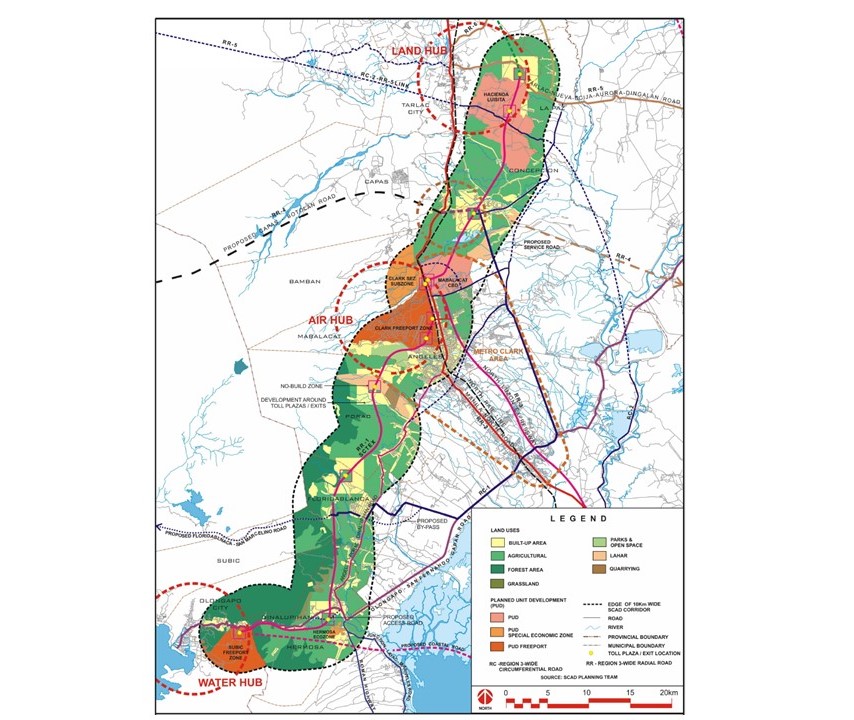
| Description | The Subic-Clark-Tarlac Expressway is a 94-kilometer toll road that traverses four Central Luzon provinces and connects three economic zones (i.e., Subic Bay Freeport Zone, Clark Freeport and Special Economic Zone, and the Hacienda Luisita and Technopark), In 2008, the Subic Clark-Alliance for Development Council (SCADC) commissioned TAM Planners to formulate the SCAD-Corridor Conceptual Land Use Plan (SCoLUP) for a 10-kilometer wide corridor along the entire 94-kilometer-long SCTEx. TAM Planners prepared a conceptual land use plan for a 100,000-hectare area in thirteen cities and municipalities that would support three hubs of production and logistics that could consequently evolve and merge into a competitive Logistics mega-hub in Asia. |
| Services Provided | The three principals of the firm with a complement of other experts and technical staff initially prepared an overall framework plan for the entire corridor based on the preliminary data gathered, focus group discussions with the mayors and planners of the LGUs, and ocular surveys of the Study Area. |
Search other projects